 JustRide.me
Georgia Covered Bridges loop Needs check
Metro / West-Central / Northeast GA · Concord Covered Bridge (Smyrna/Mableton, Cobb Co.) → Concord Covered Bridge (loop)
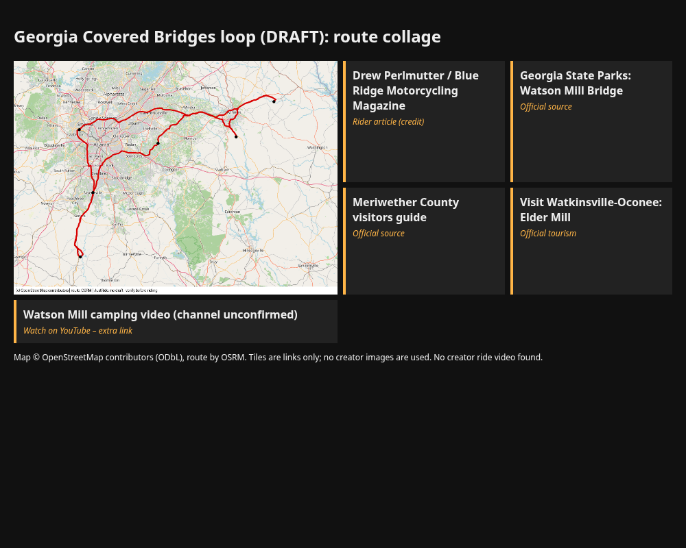
Backroads, no interstates intended (BRMM); GA-85 south toward Red Oak Creek; other legs as routed by OSRM - verify
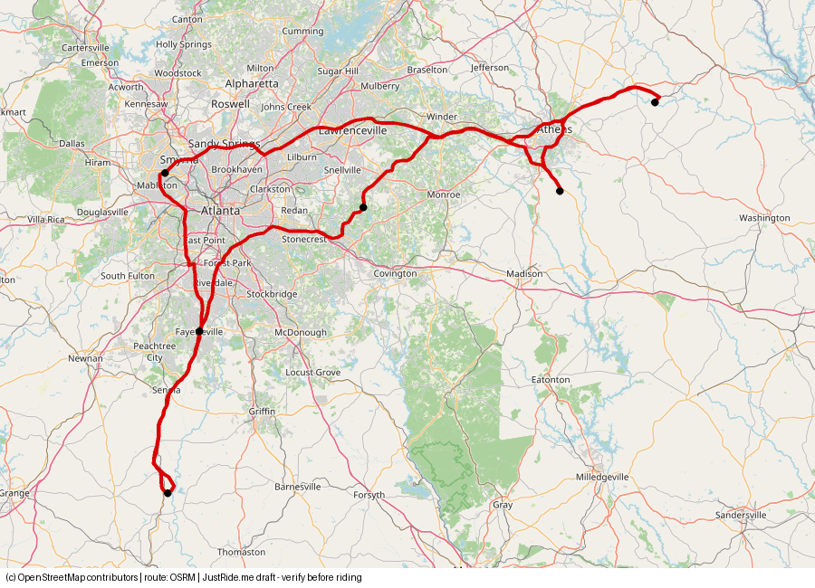
Published: not stated for one loop; article: 200-300 mi day trips (BRMM 2021) · Our track: 327.1 mi
⚠ Our track is 327.1 mi as one loop – longer than the article's 200–300 mi day trips. Plan it as two days, or take the short Elder Mill + Watson Mill option.
Download GPXDownload KMLOpen in Google Maps ↗
Caveats: Red Oak Creek: check before riding - access unconfirmed (county guide says open; Times-Georgian Feb 2026 reported closed to vehicles). Elder Mill: check before riding - access unconfirmed (county tourism says carries traffic; dirt road approach per BRMM; posted load limit). Concord: one lane, frequent temporary closures. Watson Mill: 9 ft / 3 ton, ParkPass parking fee. Single-loop day is longer than the article's 200-300 mi; the rider did these over several trips. Short option: Elder Mill + Watson Mill out-and-back ~66.6 mi (OSRM).
Highlights
Our own summaries. Timestamps come from public captions and are linked only where the caption clearly supports the highlight.
- Concord Covered Bridge (Cobb Co.) – one-lane bridge over Nickajack Creek, built 1872, about 130 ft; reached on a wooded, twisting road; very busy with car traffic (BRMM). Cobb County posted a temporary full closure for maintenance on June 23, 2026, so check for closures. source
- Red Oak Creek Covered Bridge (Meriwether Co., near Woodbury) – CHECK BEFORE RIDING – ACCESS UNCONFIRMED. Attributed to Horace King, 1840s; about 400 ft total with a 115 ft covered section (BRMM). The county visitors guide (undated) says it is still open to traffic; a Times-Georgian report (Feb 2026) said it was closed to vehicles. Rider took GA-85 south through small towns, no interstates. source
- Haralson Mill Covered Bridge (Rockdale Co., north of Conyers) – built 1997, 150 ft, over Big Haynes Creek; rider stopped to hike along the creek (BRMM). Ride-through status not confirmed by an official page – verify. source
- Elder Mill Covered Bridge (Oconee Co., near Watkinsville) – CHECK BEFORE RIDING – ACCESS UNCONFIRMED. Built 1897, moved in 1924 to Rose Creek; reached by a dirt road (BRMM). County tourism says it still carries traffic; earlier research found conflicting reports. Note the dirt approach on a road bike. source
- Watson Mill Covered Bridge (Watson Mill Bridge State Park, Comer) – Georgia's longest covered bridge, 229 ft, built 1885 by W.W. King. Park notice: 9-foot clearance, 3-ton limit; parking fee (ParkPass), park open 7 a.m.–10 p.m. (Georgia State Parks page checked 2026-11-02). source
- Food stop: the article's rider ate at Waffle House; no specific location given (not available – verify). source
- Shorter option (half day): Elder Mill + Watson Mill out-and-back, about 66.6 mi / 1.9 h drive time per OSRM. Our suggestion, not from the article.
- Creator video: no motorcycle creator video of this route was found. Extra link only: Watson Mill Bridge State Park camping video (channel not confirmed, not a ride video). source
The bridges
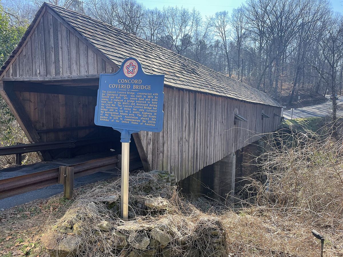
Photo: Tyler Lahti, CC BY-SA 2.0, via Wikimedia Commons (resized)
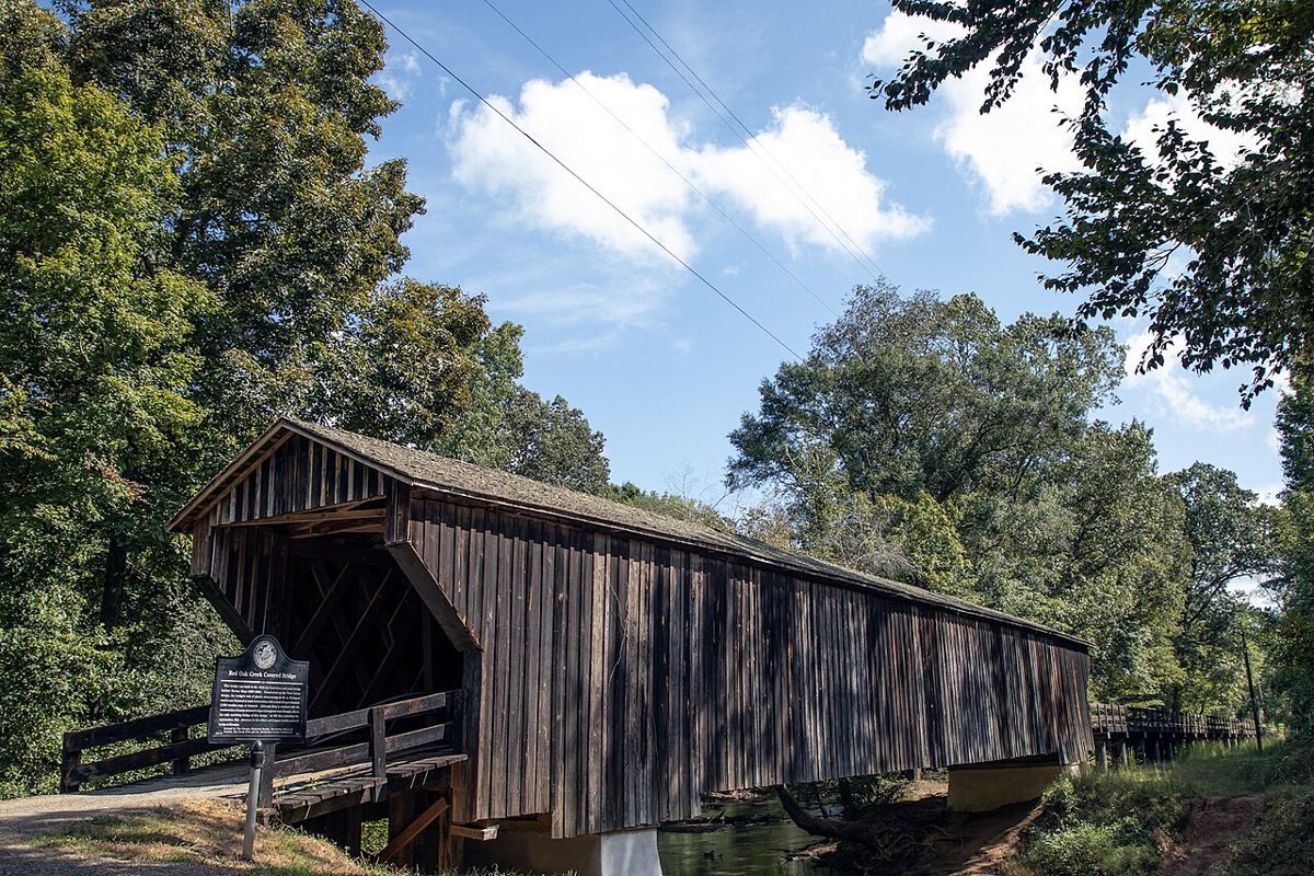
Photo: Wyoungblood1, CC BY-SA 4.0, via Wikimedia Commons (resized)
No openly licensed photo found – link only
National Bridge Inventory record (via BridgeLookup) ↗
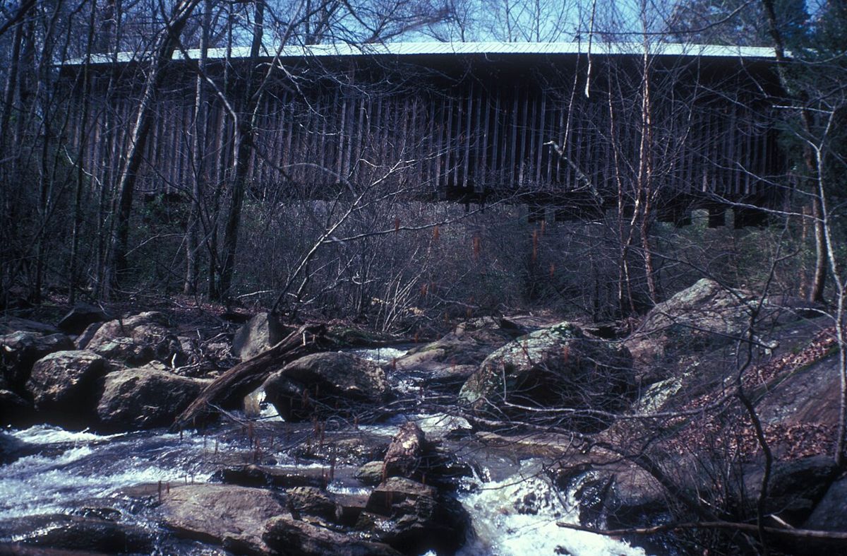
Photo: Jerrye and Roy Klotz MD, CC BY-SA 3.0, via Wikimedia Commons (resized)
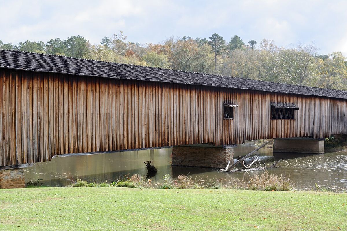
Photo: Judson McCranie (Bubba73), CC BY-SA 3.0, via Wikimedia Commons (resized)
Rider videos
Route collage
Sources
- Blue Ridge Motorcycling Magazine, Drew Perlmutter, May 13 2021 (rider route: Concord, Red Oak Creek via GA-85, Haralson Mill, Elder Mill, Watson Mill): source
- Georgia State Parks, Watson Mill Bridge SP (9 ft clearance, 3-ton limit, parking fee; checked 2026-11-02): source
- Meriwether County Visitors Guide (Red Oak 'still open to traffic', undated): source
- Visit Watkinsville-Oconee (Elder Mill carries traffic): source
- Cobb County notice of temporary Concord bridge closure 2026-06-23: source
- Visit Conyers (Haralson Mill location): source
- Coordinates: OpenStreetMap/Nominatim, except Haralson Mill (not tagged in OSM) from National Bridge Inventory record, 1997 structure: source
Credits
- map.png: our render, © OpenStreetMap contributors (ODbL), route OSRM.
- Route idea and bridge order: Blue Ridge Motorcycling Magazine – Drew Perlmutter, May 13, 2021. Link only; our own wording; no text or photos copied. **Cleared (link + credit).** Using their photos would need permission.
- Bridge facts: Georgia State Parks, Meriwether County visitors guide, Visit Watkinsville-Oconee, Cobb County notice. Facts only.
- Extra link tile: Watson Mill Bridge SP camping video (YouTube; channel not confirmed). Link only. Thumbnails/frames would need creator permission.
- Creator video for the route: none found.
- Bridge photo, Concord Covered Bridge: Tyler Lahti, CC BY-SA 2.0, via Wikimedia Commons. Resized to 1200 px; resized copy shared under CC BY-SA 2.0.
- Bridge photo, Red Oak Creek Covered Bridge: Wyoungblood1, CC BY-SA 4.0, via Wikimedia Commons. Resized to 1200 px; resized copy shared under CC BY-SA 4.0.
- Bridge photo, Elder Mill Covered Bridge: Jerrye and Roy Klotz MD, CC BY-SA 3.0, via Wikimedia Commons. Resized to 1200 px; resized copy shared under CC BY-SA 3.0.
- Bridge photo, Watson Mill Covered Bridge: Judson McCranie (Bubba73), CC BY-SA 3.0, via Wikimedia Commons. Resized to 1200 px; resized copy shared under CC BY-SA 3.0.
- Haralson Mill Covered Bridge: no openly licensed photo found on Wikimedia Commons or HABS/HAER (checked 2026-11-02); link tile only to the National Bridge Inventory record. No image hosted.
Map © OpenStreetMap contributors (ODbL); route drawn with OSRM. Videos belong to their creators. Always check roads and conditions before riding. Status: Needs check.